Specimens
Surface digitization
Create shareable records for visible fossil geometry, casts, bones, and prepared material.
Abound 3D for Paleontology
Abound helps paleontology teams digitize fossils, preserve field context, compare specimens across collections, and share research-ready 3D records without building a heavy capture pipeline.
Used across research, education, and media workflows


Create shareable records for visible fossil geometry, casts, bones, and prepared material.
Capture excavation surfaces and in situ relationships before context changes.
Keep browser-viewable models available for collaborators, students, and reviewers.
Decide whether the scan needs specimen geometry, field context, teaching access, publication reference, or export for analysis.
Use photo-based capture or LiDAR workflows to document the fossil, excavation surface, or surrounding spatial context.
Review the model in Abound, share a browser link with collaborators, and export files when the project needs downstream tools.
Digitize bones with enough detail to compare specimens side by side even when fossils are held in different museums across the world.
Expand morphological studies beyond small sample sizes by capturing more specimens with handheld scanners during collections visits and fieldwork.
Map field sites and in situ context in 3D using photogrammetry and LiDAR, while keeping GPS points for site indexing and reporting.
Pair fast surface scans with targeted CT or micro-CT studies so teams can reserve costly internal imaging for the most critical specimens.
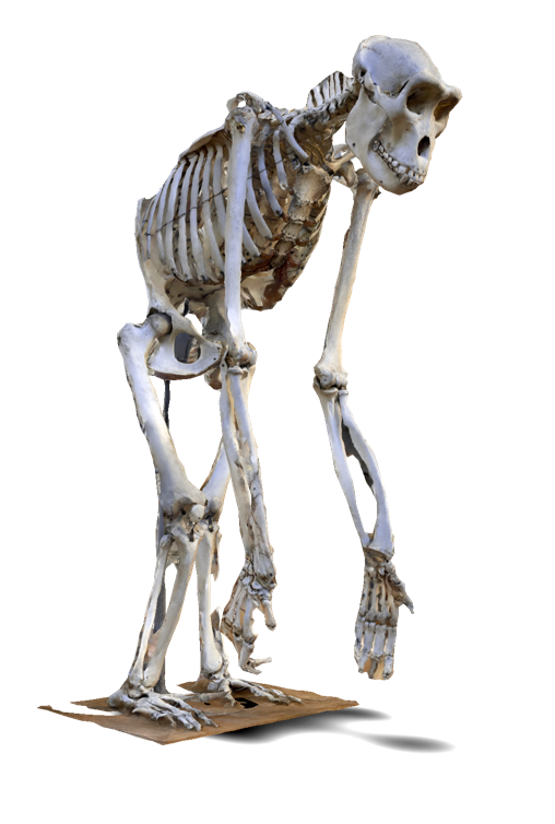
Public skeletal and specimen scans show how morphology and display context can be preserved for remote review and teaching.
Build 3D records for prepared fossils, casts, comparative material, teaching collections, and fragile specimens that should be handled less often.
Give collaborators a consistent surface model for qualitative comparison, measurement planning, and character discussion before deeper analysis.
Use photo and LiDAR capture to document trenches, quarry blocks, trackways, and in situ relationships as excavation progresses.
Keep shareable 3D records organized by collection, locality, specimen group, or project so teams can revisit context later.
Surface scans can preserve specimen shape, field context, and handling-sensitive details in a shareable 3D record for comparison, teaching, publication support, and collaboration.
No. Surface scanning is useful for visible geometry and context, while CT and micro-CT remain important for internal structure. Many teams can use surface scans for broader digitization and reserve CT time for targeted questions.
Yes. Photo-based capture and LiDAR workflows can help document excavation areas, track in situ relationships, and preserve field context before material is moved.
Abound stores models in a cloud library, so teams can share browser-viewable records with collaborators before deciding whether to export files for analysis, archives, or presentation.